The problem
Land ownership in England is hard to find out about. It is also tied to power, money and influence. There is no public list of who owns what land or property in the UK.
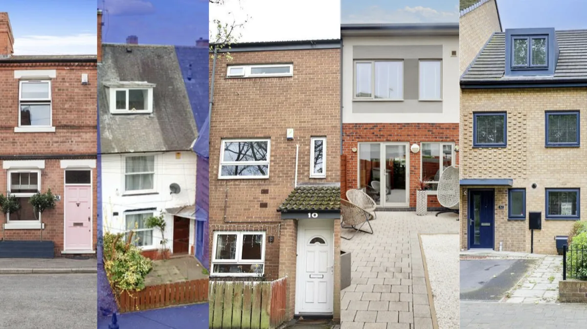
I used free data and software to predict how old buildings are. This helped a community in The Meadows, Nottingham decide which energy-saving upgrades suit them best, such as loft insulation.
The work became my MRes thesis: Initial steps towards an open cadastre in the UK: a case study (University of Nottingham, 2024). A cadastre is a public record of who owns land.
What I did
-
Agreed what the map needed
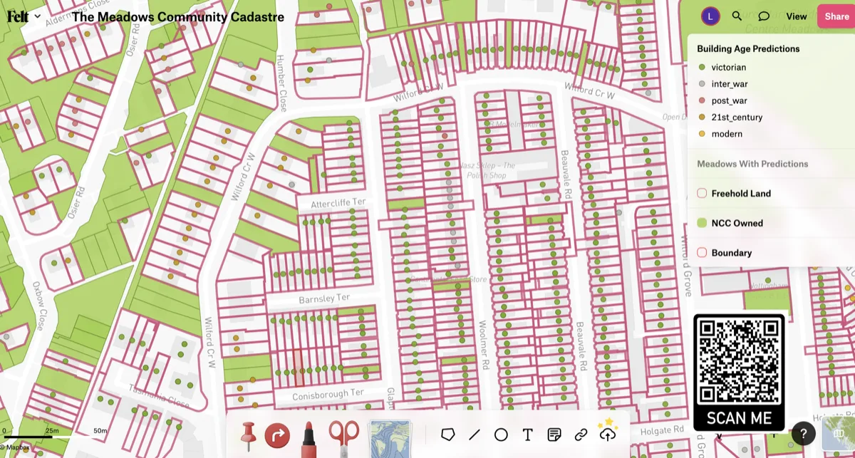
I worked with a climate change charity to agree what success looked like. We wanted a map people could view, showing who owns the land and what types of house there are.
-
Found open data and tools
I used local council data, OpenStreetMap and INSPIRE Index Polygons (a dataset of land parcels). I processed it with QGIS, Jupyter Notebooks, Python and Felt.
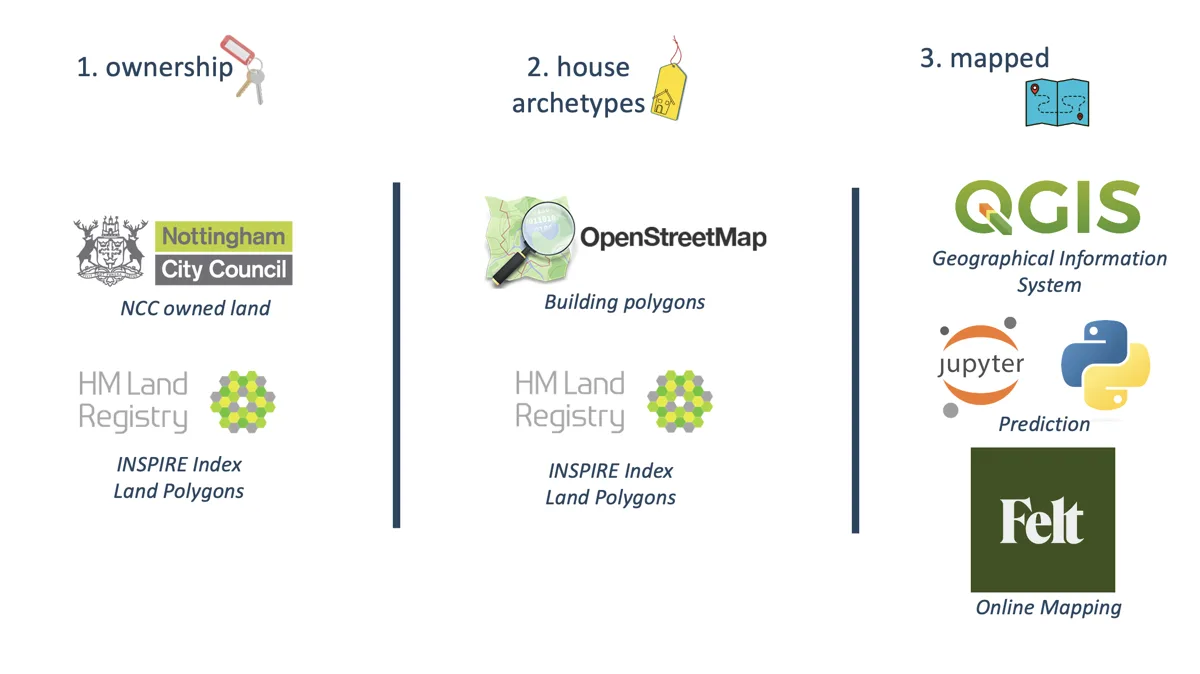
The open data and tools I used. -
Used machine learning
I predicted how old each building is. The model used the size of the plot, its perimeter, its location, and how much of the plot the building covers.
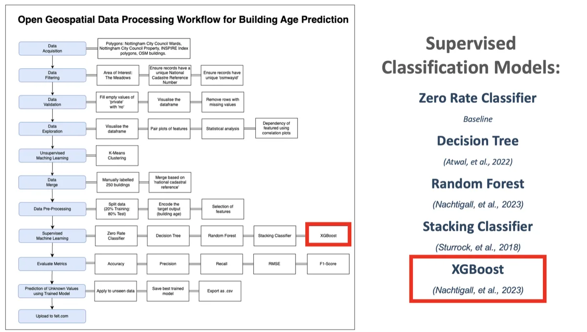
The machine learning workflow, with the models I tested. -
Tested the idea
I tested several types of algorithm. I then put the predictions on an interactive map.
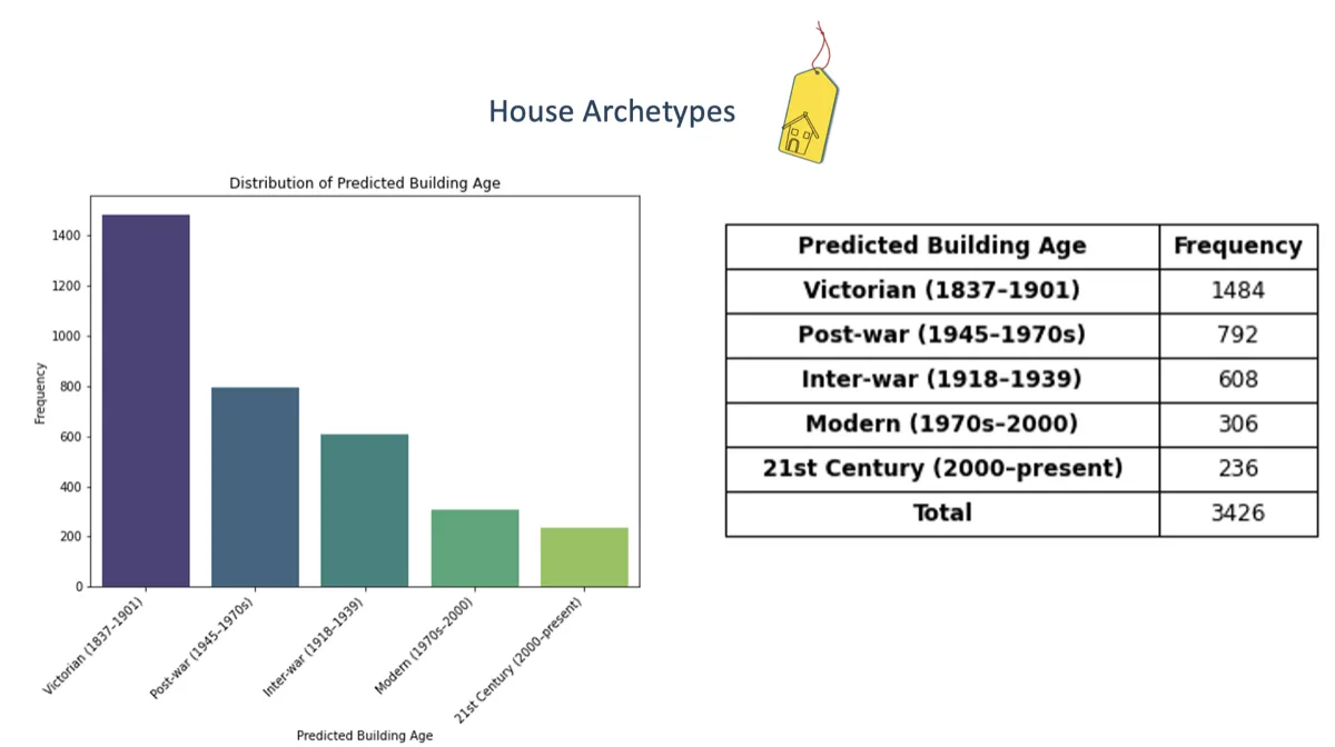
Predicted building ages from the model.
The result
The result is a working web application. It uses only open data and open-source software. Other communities could copy the approach, and it is affordable for groups with little money.